Wednesday, 1 August, 2012
 The road to the Oberalp Pass from Andermatt goes straight up the side of the mountain.
The uphill is utterly relentless for almost 7km, and combined with the thin alpine air my heart was pounding almost immediately.
I can’t have been more than a kilometre out of Andermatt when I heard a noise that filled me with dread. The clicking coming from the rear of the bike was getting louder and louder, and when I looked round I saw something worse than I could have possibly imagined.
I was about to be overtaken by a guy on roller blades using a set of ski poles.
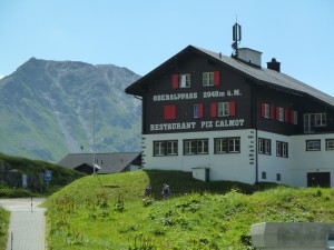
It took well over an hour of gruelling slog to reach the point where the road started flattening off, and from there I made fairly rapid progress to the Oberalp Pass at 2042m, and first sight of the rivulet of water that is the Rhine.
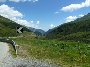
It was really tough going, but well worth it. The view down the Rhine valley was amazing, and I hardly touched the pedals for the next 21km as I let gravity take over on the steep run down to Decentis, passing through chocolate box perfect towns along the way.
I’d really enjoyed the ride up to this stage.
After lunch things got a bit tougher again, and although the general trajectory was still downwards there were long sections of flat for the next 30km, along with a fierce headwind that made it quite tough going in the blistering heat.
It felt a bit like cycling into a hairdryer.
I was just starting to feel tired when it appeared in front of me. Another hill.
At first it didn’t look too bad, and although I was struggling a bit with the heat I was looking forward to getting past it. I’d really thought the hilly section was behind me, but this thing just kept going up and up for about 10km in the scorching heat and for the most part at an even steeper gradient than the Oberalp Pass Road from Andermatt.
It almost destroyed me over the course of two very painful hours, and to make matters worse the route was now very busy with lorries and cars whizzing past my left hand shoulder. By the time I got to the summit and a petrol station my entire body was craving calories, which were rapidly consumed in the form of an ice-cream and a can of pop.
Somehow it didn’t feel like nearly as much as I’d expended on the way up.
I’d been following highway 19 which should have taken me all the way into Chur, but my next challenge came at the summit of the hill when I reached a long road tunnel with signs prohibiting cyclists. I’m travelling without a map (on the basis it would be hard to lose the Rhine) so this gave me serious pause for thought as I had a choice of two alternative turnings, but no idea which would get me to Chur.
By this stage I really couldn’t have cared less about where I ended up, so I took the option that came most naturally – the one that went downhill. I figured it would end up at the bottom of the valley sometime, and from there I would be able pick up the Rhine again.
The route down through Flims was very fast, and I must have hit speeds of over 50km per hour in places as I raced toward the valley floor, rather fortuitously picking up the 19 again as it exited the mountain further down.
I’d only managed another kilometre of the 19 before hitting another tunnel prohibited to cyclists, with the alternate route involving another uphill while the tunnel went down into the mountain. I was hardly in the mood for it, but at least this time the gradient wasn’t too bad, and after another swift downhill section on the other side I once again rejoined the 19 a couple of km’s later.
Just outside Chur I picked up a cycle path that ran alongside the Rhine, which by this stage has turned into quite a substantial fast flowing river. This was more like what I’d signed up for, and despite the exhaustion I found myself starting to enjoy the ride again.
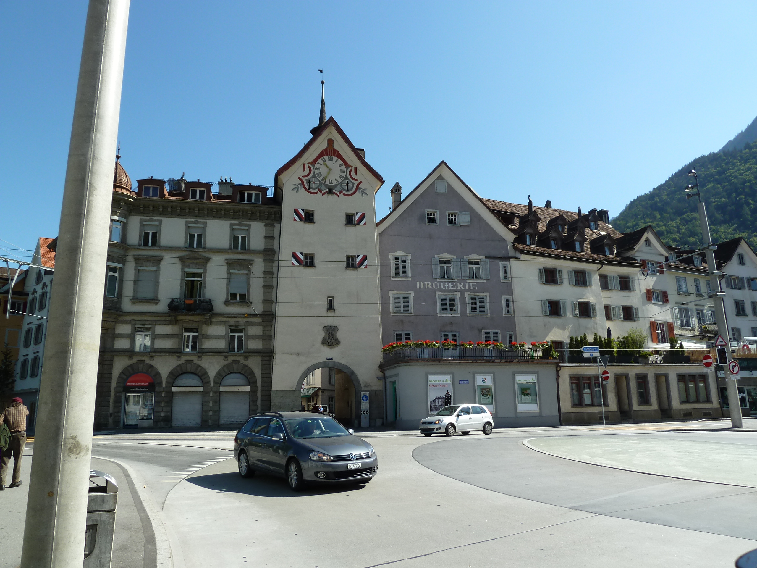 I finally arrived in Chur 8 hours after leaving Andermatt, booked into a hotel and immediately ran myself a cold bath to try and revive my aching limbs.
I am quite sure the ride is going to throw up lots more challenges along the way, but it feels really good to have completed what is undoubtedly the most physically demanding section. A quick check on the internet confirmed what I was hoping for.
It really is all downhill from here.
Statistics:
Distance, 95km (plus the unplanned bits)
c. 1.5km of combined elevation
8 hours total (of which about 7 hours was ride time)
I’ll have to catch up on photo’s at a later stage, as can’t get them to upload from here.
Footnote:
The lack of a map kicked in right from the get go. I had no idea about the second hill.
It was grim, and I was really shaking by the time I got the the petrol station. I just wanted it to be over. Thankfully the downhill on the other side was really awesome, and very, very fast.
The highlight of my evening in Chur was a Kebab.
I must have been in shock, because I don’t usually eat Kebabs.
Index
I think the first bit might be a bit hilly
Day 2 – Chur to Rorschach and lunching in Lichtenstein
Day 3 – Rorschach to Shaffhausen and the need for professional help
Day 4 – Schaffausen to Basel and the end of the Swiss section
Day 6 – Strasbourg to Karlsruhe
Day 7 – Karlsruhe to Goddelau and more getting lost
Day 8 – Goddelau to Koblenz on a spoke and a prayer
Day 9 – Koblenz to Cologne, the day I hit the wall
Day 10 – moving North from Cologne
Day 11 – Nijmegen to Gorinchem, clogging it along the dijks
Day 12-13 Gronichem to Hoek van Holland and the end of the Rhine
Be First to Comment